
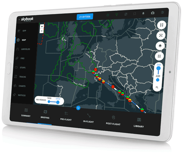
Interactive Map

Real-time situational awareness of route
One glance, total clarity. The interactive EFB map delivers critical route insights instantly.
Part of the flight briefing, designed to provide pilots with full awareness of their scheduled flights.
With intuitive weather layers and planned position data, giving clear route insights and awareness of conditions.
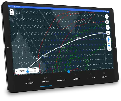
Weather layers
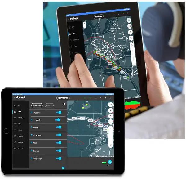
The user-friendly EFB weather & environment layers can be easily toggled on or off. Weather insights include:
- Upper wind and temperature
- Clear air turbulence
- CB cloud
- Cyclones
- Volcanoes
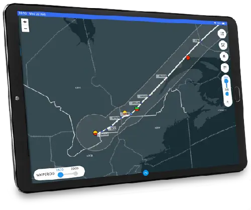
Environment awareness
A selection of detailed environment layers ensure you have full awareness of the flight ahead. These include:
- Waypoints
- Airfields including METAR, TAF & NOTAM data
- Route buffer
- FIRs
- Graticule
- Range rings
Auto refresh route data
Weather and NOTAM data is sourced from trusted providers and auto-refreshes to ensure accurate, real-time decision-making.
Interactive weather layers within the EFB briefing give pilots the precise insights they need, tailored to their planned route.
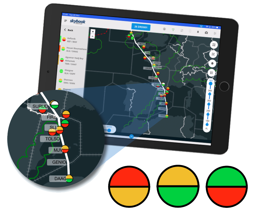
Airfield Status Symbols
Pilots gain quick awareness by glancing at the Airfield status symbols.
Airfield symbols are colour-coded in two halves: the top indicates weather conditions, while the bottom reflects NOTAM status.
Red is Critical, Amber is Warning, Green is Normal. Based on your minima settings.
Tapping an airfield reveals details about any weather or NOTAM issues affecting that location
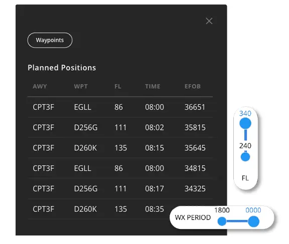
Planned position data
Pilots can visualise the route being flown with waypoint planned position data, flight levels and times.
Ensuring pilots have real-time briefing information they need to support their flight.
Pair this with our streamlined flight phase journey log to capture the critical data that drives your flight operations.